Fichye:Hail Blount House, San Augustine, Texas.jpg
Dimansyon previzyalizasyon sa a : 800 × 572 piksèl. Lòt rezolisyon yo: 320 × 229 piksèl | 640 × 458 piksèl | 1 024 × 732 piksèl.
Fichye orijinal (1 024 × 732 piksèl, gwosè fichye a : 182 kio, tip MIME li ye : image/jpeg)
Rezime
| Deskripsyon |
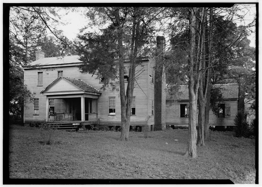
English: Hail / Captain Thomas William Blount House, San Augustine, Texas.
|
|||||
| Dat | ||||||
| Sous |
|
|||||
| Kreyatè | Harry L. Starnes |

| Position de l'objet | | Voir cet endroit et d’autres images sur : OpenStreetMap |
|---|
|
Ceci est une photographie d’un monument référencé dans le National Register of Historic Places des États-Unis sous le numéro 73001974. |
Kondisyon itlizasyon
Ce média est dans le domaine public des États-Unis d’Amérique car son auteur est l’administration américaine comme précisé dans le code fédéral au Titre 17, Chapitre 1, Section 105. Pour en savoir plus : droit d’auteur.
Attention : Ceci ne concerne que le travail du Gouvernement Fédéral et pas celui des États, ou d’une autre subdivision géographique ou politique du pays.
|
 | |
| Ce fichier a été identifié comme étant exempt de restrictions connues liées au droit d’auteur, y compris tous les droits connexes et voisins. | ||
Istorik fichye a
Klike sou yon dat/yon lè pou wè fichye a jan li te ye nan moman sa a.
| Dat ak lè | Minyati | Grandè yo | Itilizatè | Komantè | |
|---|---|---|---|---|---|
| Kounye a | 1 avril 2012 à 11:18 | | 1 024 × 732 (182 kio) | 25or6to4 |
Itilizasyon fichye sa a
paj sa a itilize fichye sa a:
Itilizasyon global fichye a
Wiki sa a yo sèvi ak fichye sa a:
- Itilizasyon sou ar.wikipedia.org
- Itilizasyon sou arz.wikipedia.org
- Itilizasyon sou azb.wikipedia.org
- Itilizasyon sou be.wikipedia.org
- Itilizasyon sou ceb.wikipedia.org
- Itilizasyon sou ce.wikipedia.org
- Itilizasyon sou cy.wikipedia.org
- Itilizasyon sou en.wikipedia.org
- Itilizasyon sou en.wikivoyage.org
- Itilizasyon sou es.wikipedia.org
- Itilizasyon sou eu.wikipedia.org
- Itilizasyon sou fa.wikipedia.org
- Itilizasyon sou fr.wikipedia.org
- Itilizasyon sou ga.wikipedia.org
- Itilizasyon sou hu.wikipedia.org
- Itilizasyon sou it.wikipedia.org
- Itilizasyon sou lld.wikipedia.org
- Itilizasyon sou pl.wikipedia.org
- Itilizasyon sou pt.wikipedia.org
- Itilizasyon sou ru.wikipedia.org
- Itilizasyon sou sr.wikipedia.org
- Itilizasyon sou tt.wikipedia.org
- Itilizasyon sou uk.wikipedia.org
- Itilizasyon sou www.wikidata.org
- Itilizasyon sou zh-min-nan.wikipedia.org
- Itilizasyon sou zh.wikipedia.org