Fichye:Maricopa County Incorporated and Planning areas Sun City highlighted.svg

Taille de cet aperçu PNG pour ce fichier SVG : 694 × 599 piksèl. Lòt rezolisyon yo: 278 × 240 piksèl | 556 × 480 piksèl | 889 × 768 piksèl | 1 185 × 1 024 piksèl | 2 371 × 2 048 piksèl | 940 × 812 piksèl.
Fichye orijinal (Fichye SVG, rezolisyon de 940 × 812 piksèl, gwosè fichye : 1,05 Mio)
Rezime
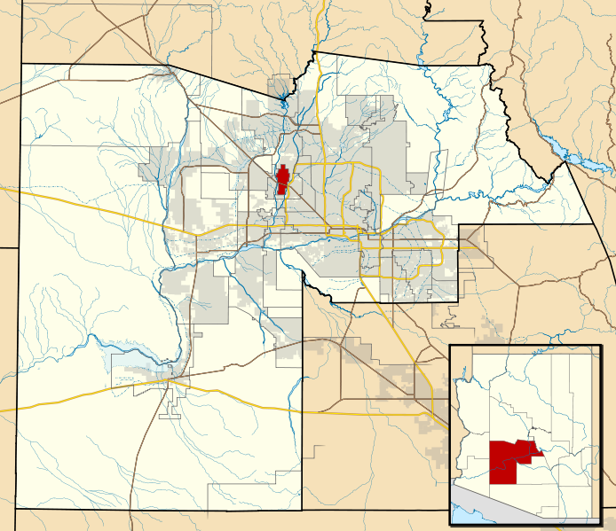
| Deskripsyon | This map shows the incorporated areas and Indian reservation boundaries in Maricopa County, Arizona, along with water bodies and major highways and roads. Sun City is highlighted in red. Other incorporated cities are shown in gray, planning area borders for these cities and Indian reservation borders are shown as solid black lines. Changes from Previous Version: Updated the maps to include water bodies and to make "less boring" than the plain black/white/gray maps. Format was updated to match standards laid out by WikiProject Maps/Conventions. Map data is based on data from the following Webpage: Maricopa County Interactive GIS Map. I created this map in Inkscape. |
| Dat | |
| Sous | My own work, based on government information |
| Kreyatè | Ixnayonthetimmay |
| Pèmisyon : (Resèvi ak fichye sa a) |
Public Domain |
| Autres versions | See Category:Maps of Maricopa County for other versions of this image. |
Kondisyon itlizasyon
| Moi, propriétaire des droits d’auteur sur cette œuvre, la place dans le domaine public. Ceci s'applique dans le monde entier. Dans certains pays, ceci peut ne pas être possible ; dans ce cas : J’accorde à toute personne le droit d’utiliser cette œuvre dans n’importe quel but, sans aucune condition, sauf celles requises par la loi. |
Istorik fichye a
Klike sou yon dat/yon lè pou wè fichye a jan li te ye nan moman sa a.
| Dat ak lè | Minyati | Grandè yo | Itilizatè | Komantè | |
|---|---|---|---|---|---|
| Kounye a | 20 me 2011 à 06:44 | | 940 × 812 (1,05 Mio) | Ixnayonthetimmay | Uploading new version |
| 30 out 2008 à 04:43 |  | 900 × 800 (413 kio) | Ixnayonthetimmay | == Summary == {{Information |Description=This map shows the incorporated areas and unincorporated areas in Maricopa County, Arizona. [[:en:Sentinel, Arizona| | |
| 15 septanm 2007 à 23:43 |  | 900 × 800 (385 kio) | Ixnayonthetimmay | {{Information |Description= |Source= |Date= |Author= |Permission= |other_versions= }} | |
| 28 me 2007 à 10:14 |  | 900 × 780 (330 kio) | Ixnayonthetimmay | ||
| 22 me 2007 à 01:20 |  | 900 × 780 (322 kio) | Ixnayonthetimmay | ||
| 30 janvye 2007 à 05:26 |  | 904 × 758 (178 kio) | Ixnayonthetimmay | {{Information |Description=This map shows the incorporated areas in Maricopa County, Arizona, highlighting Sun City in red. It also shows the boundaries for the |
Itilizasyon fichye sa a
paj sa a itilize fichye sa a:
Itilizasyon global fichye a
Wiki sa a yo sèvi ak fichye sa a:
- Itilizasyon sou ar.wikipedia.org
- Itilizasyon sou arz.wikipedia.org
- Itilizasyon sou azb.wikipedia.org
- Itilizasyon sou ca.wikipedia.org
- Itilizasyon sou ceb.wikipedia.org
- Itilizasyon sou de.wikipedia.org
- Itilizasyon sou eu.wikipedia.org
- Itilizasyon sou fa.wikipedia.org
- Itilizasyon sou fr.wikipedia.org
- Itilizasyon sou it.wikipedia.org
- Itilizasyon sou simple.wikipedia.org
- Itilizasyon sou sr.wikipedia.org
- Itilizasyon sou tt.wikipedia.org
- Itilizasyon sou vo.wikipedia.org
- Itilizasyon sou www.wikidata.org
- Itilizasyon sou zh-min-nan.wikipedia.org
- Itilizasyon sou zh.wikipedia.org