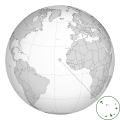
Fichye:CPV orthographic NaturalEarth.svg

Taille de cet aperçu PNG pour ce fichier SVG : 550 × 550 piksèl. Lòt rezolisyon yo: 240 × 240 piksèl | 480 × 480 piksèl | 768 × 768 piksèl | 1 024 × 1 024 piksèl | 2 048 × 2 048 piksèl.
Fichye orijinal (Fichye SVG, rezolisyon de 550 × 550 piksèl, gwosè fichye : 235 kio)
Istorik fichye a
Klike sou yon dat/yon lè pou wè fichye a jan li te ye nan moman sa a.
| Dat ak lè | Minyati | Grandè yo | Itilizatè | Komantè | |
|---|---|---|---|---|---|
| Kounye a | 13 desanm 2019 à 18:08 |  | 550 × 550 (235 kio) | Goran tek-en | Added border for South Sudan as requested by {{u|Maphobbyist}} |
| 6 septanm 2010 à 12:27 |  | 550 × 550 (637 kio) | Gringer | slight shading to map area | |
| 6 septanm 2010 à 12:18 |  | 550 × 550 (637 kio) | Gringer | darker country areas, dotted lines, transparency | |
| 3 septanm 2010 à 12:37 |  | 550 × 550 (584 kio) | Gringer | projecting outside the circle | |
| 1 septanm 2010 à 03:58 |  | 550 × 550 (584 kio) | Gringer | blur doesn't appear on thumbnail, so removing | |
| 1 septanm 2010 à 03:55 |  | 550 × 550 (584 kio) | Gringer | zoomed high resolution map of islands | |
| 30 out 2010 à 23:40 |  | 550 × 550 (575 kio) | Gringer | {{Information |Description={{en|1=A map of the hemisphere centred on Cape Verde, using an orthographic projection, created using gringer's Perl script with [http://www.naturalearthdata.com/ Natural Earth |
Itilizasyon fichye sa a
paj sa a itilize fichye sa a:
Itilizasyon global fichye a
Wiki sa a yo sèvi ak fichye sa a:
- Itilizasyon sou ar.wikipedia.org
- Itilizasyon sou arz.wikipedia.org
- Itilizasyon sou ast.wikipedia.org
- Itilizasyon sou az.wikipedia.org
- Itilizasyon sou be-tarask.wikipedia.org
- Itilizasyon sou ca.wikipedia.org
- Itilizasyon sou ce.wikipedia.org
- Itilizasyon sou cs.wikipedia.org
- Itilizasyon sou de.wikivoyage.org
- Itilizasyon sou diq.wikipedia.org
- Itilizasyon sou en.wikipedia.org
- Itilizasyon sou es.wikipedia.org
- Itilizasyon sou eu.wikipedia.org
- Itilizasyon sou fi.wikivoyage.org
- Itilizasyon sou fr.wikinews.org
- Itilizasyon sou ga.wikipedia.org
- Itilizasyon sou gl.wikipedia.org
- Itilizasyon sou gn.wikipedia.org
- Itilizasyon sou ha.wikipedia.org
- Itilizasyon sou ia.wikipedia.org
- Itilizasyon sou ie.wikipedia.org
- Itilizasyon sou it.wikipedia.org
- Itilizasyon sou jam.wikipedia.org
- Itilizasyon sou kab.wikipedia.org
- Itilizasyon sou ku.wikipedia.org
- Itilizasyon sou mdf.wikipedia.org
- Itilizasyon sou pt.wikipedia.org
- Itilizasyon sou pt.wikibooks.org
- Itilizasyon sou ru.wikipedia.org
- Itilizasyon sou shi.wikipedia.org
- Itilizasyon sou ur.wikipedia.org
- Itilizasyon sou www.wikidata.org


