Fichye:French Polynesia (orthographic projection, yellowblue).svg

Taille de cet aperçu PNG pour ce fichier SVG : 501 × 501 piksèl. Lòt rezolisyon yo: 240 × 240 piksèl | 480 × 480 piksèl | 768 × 768 piksèl | 1 024 × 1 024 piksèl | 2 048 × 2 048 piksèl.
Fichye orijinal (Fichye SVG, rezolisyon de 501 × 501 piksèl, gwosè fichye : 291 kio)
.svg)
Rezime
| Deskripsyon |
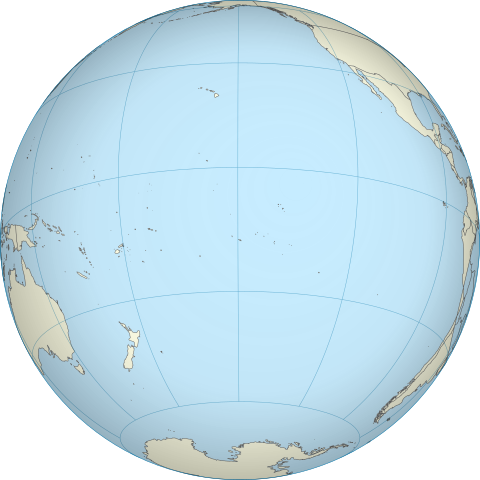
English: A map of the hemisphere centred on French Polynesia, using an orthographic projection, created using gringer's Perl script with Natural Earth Data (1:50000 resolution, simplified to 0.01px). Français : Représentation du globe terrestre centrée sur la Polynésie française. Carte en projection orthographique, générée par le script de Gringer en langage Perl avec les données du site www.naturalearthdata.com. Résolution 1:50000, simplifiée à 0,01 pixel. |
| Dat | |
| Sous | Travay pèsonèl |
| Kreyatè | Gringer |
| Autres versions | |
| SVG | W3C-validity not checked. Cette image vectorielle non W3C-spécifiée a été créée avec Inkscape . |
.svg)
| Lieu de la prise de vue | | Voir cet endroit et d’autres images sur : OpenStreetMap |
|---|
.svg¶ms=-17.500000_N_-149.500000_E_globe:Earth_type:camera_type:satellite_dim:40000km_heading:0.00&language=ht)
Kondisyon itlizasyon
| Moi, propriétaire des droits d’auteur sur cette œuvre, la place dans le domaine public. Ceci s'applique dans le monde entier. Dans certains pays, ceci peut ne pas être possible ; dans ce cas : J’accorde à toute personne le droit d’utiliser cette œuvre dans n’importe quel but, sans aucune condition, sauf celles requises par la loi. |
Istorik fichye a
Klike sou yon dat/yon lè pou wè fichye a jan li te ye nan moman sa a.
| Dat ak lè | Minyati | Grandè yo | Itilizatè | Komantè | |
|---|---|---|---|---|---|
| Kounye a | 27 avril 2011 à 17:38 | | 501 × 501 (291 kio) | Sémhur | Try to see the map |
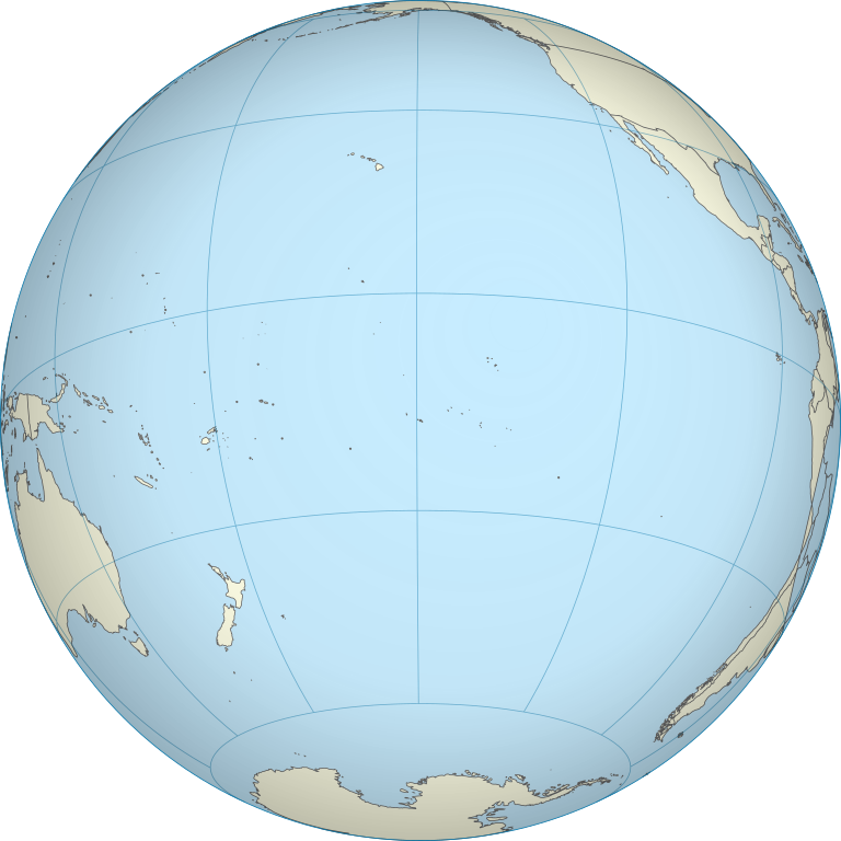
| 5 oktòb 2010 à 12:54 |  | 550 × 550 (744 kio) | Gringer | {{Information |Description={{en|1=A map of the hemisphere centred on French Polynesia, using an orthographic projection, created using gringer's Perl script with Natural Earth Data (1:50000 resolution, simplified to 0.25px). }} |Source={{own}} |Author=[[U |
Itilizasyon fichye sa a
Pa gen okenn paj ki itilize dosye sa a.
Itilizasyon global fichye a
Wiki sa a yo sèvi ak fichye sa a:
- Itilizasyon sou en.wikipedia.org
- Itilizasyon sou pt.wikipedia.org
.svg)