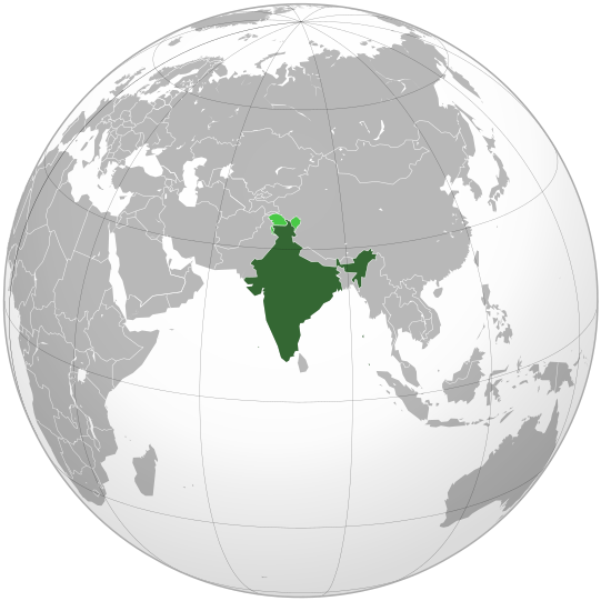
Fichye:India (orthographic projection).svg

Taille de cet aperçu PNG pour ce fichier SVG : 541 × 541 piksèl. Lòt rezolisyon yo: 240 × 240 piksèl | 480 × 480 piksèl | 768 × 768 piksèl | 1 024 × 1 024 piksèl | 2 048 × 2 048 piksèl.
Fichye orijinal (Fichye SVG, rezolisyon de 541 × 541 piksèl, gwosè fichye : 280 kio)
Istorik fichye a
Klike sou yon dat/yon lè pou wè fichye a jan li te ye nan moman sa a.
| Dat ak lè | Minyati | Grandè yo | Itilizatè | Komantè | |
|---|---|---|---|---|---|
| Kounye a | 26 avril 2023 à 07:10 |  | 541 × 541 (280 kio) | Swtadi143 | Reverted to version as of 07:34, 16 September 2021 (UTC) siachen glacier is fully controlled by india and not india pakistan jointly, see Siachen conflict for context. |
| 20 septanm 2021 à 10:02 |  | 512 × 512 (155 kio) | Ytpks896 | Reverted to version as of 17:38, 6 September 2021 (UTC) Siachen is a disputed territory not fully controlled by single country it is controlled by both Pakistan and india & some parts by china | |
| 16 septanm 2021 à 07:34 |  | 541 × 541 (280 kio) | Ksh.andronexus | Reverted to version as of 16:08, 19 December 2019 (UTC) | |
| 6 septanm 2021 à 17:38 |  | 512 × 512 (155 kio) | Milenioscuro | Siachen is a disputed territory between China, India and Pakistan | |
| 19 desanm 2019 à 16:08 |  | 541 × 541 (280 kio) | Goran tek-en | Added border for South Sudan as requested by {{u|Maphobbyist}} | |
| 21 oktòb 2017 à 14:04 |  | 541 × 541 (139 kio) | Goran tek-en | Added Siachen Glacier as requested by {{u|King Prithviraj II}} | |
| 12 septanm 2012 à 21:31 |  | 541 × 541 (167 kio) | Palosirkka | Scrubbed with http://codedread.com/scour/ | |
| 15 novanm 2009 à 23:40 |  | 541 × 541 (573 kio) | Shibo77 | +Eritrea, Yemen; -neutral zone | |
| 1 novanm 2009 à 13:18 |  | 541 × 541 (496 kio) | Pahari Sahib | Map showing territory governered by India, see map of Pakistan | |
| 11 mas 2009 à 13:17 |  | 541 × 541 (572 kio) | Tryphon | Reverted to version as of 22:12, 13 February 2009: please use the talk page before reverting this image; there are apparently many people who want the map this way. |
Itilizasyon fichye sa a
paj sa a itilize fichye sa a:
Itilizasyon global fichye a
Wiki sa a yo sèvi ak fichye sa a:
- Itilizasyon sou ace.wikipedia.org
- Itilizasyon sou ady.wikipedia.org
- Itilizasyon sou af.wikipedia.org
- Itilizasyon sou ami.wikipedia.org
- Itilizasyon sou am.wikipedia.org
- Itilizasyon sou anp.wikipedia.org
- Itilizasyon sou an.wikipedia.org
- Itilizasyon sou arc.wikipedia.org
- Itilizasyon sou ar.wikipedia.org
- Itilizasyon sou ar.wiktionary.org
- Itilizasyon sou arz.wikipedia.org
- Itilizasyon sou ast.wikipedia.org
- Itilizasyon sou as.wikipedia.org
- Itilizasyon sou atj.wikipedia.org
- Itilizasyon sou avk.wikipedia.org
- Itilizasyon sou av.wikipedia.org
- Itilizasyon sou awa.wikipedia.org
- Itilizasyon sou azb.wikipedia.org
- Itilizasyon sou az.wikipedia.org
- Itilizasyon sou az.wiktionary.org
- Itilizasyon sou ban.wikipedia.org
- Itilizasyon sou bat-smg.wikipedia.org
- Itilizasyon sou ba.wikipedia.org
- Itilizasyon sou bbc.wikipedia.org
- Itilizasyon sou bcl.wikipedia.org
- Itilizasyon sou be-tarask.wikipedia.org
- Itilizasyon sou beta.wikiversity.org
- Itilizasyon sou be.wikipedia.org
- Itilizasyon sou bg.wikipedia.org
- Itilizasyon sou bh.wikipedia.org
- Itilizasyon sou bi.wikipedia.org
- Itilizasyon sou bjn.wikipedia.org
Gade plis itilizasyon global fichye sa a.


