Fichye:Aerial-GoletaArea.jpg
Dimansyon previzyalizasyon sa a : 800 × 323 piksèl. Lòt rezolisyon yo: 320 × 129 piksèl | 1 024 × 413 piksèl.
Fichye orijinal (1 024 × 413 piksèl, gwosè fichye a : 109 kio, tip MIME li ye : image/jpeg)
Rezime
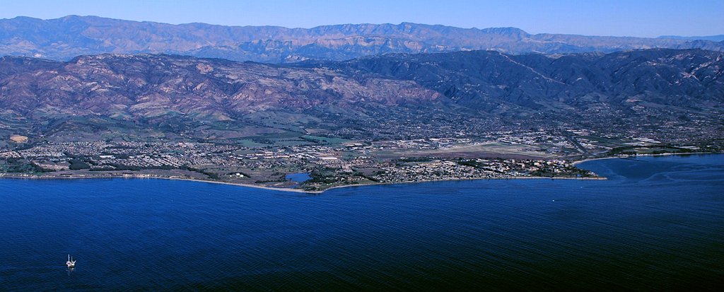
| Deskripsyon |
Aerial photo of the Goleta area, Santa Barbara County, California — from offshore.
|
| Dat | 11am |
| Sous | Travay pèsonèl |
| Kreyatè | John Wiley User:Jw4nvc - Santa Barbara, California |
| Pèmisyon : (Resèvi ak fichye sa a) |
*For full details on Permissions for this user's work, see: User:Jw4nvc/permission/details |
Kondisyon itlizasyon
Moi, en tant que détenteur des droits d’auteur sur cette œuvre, je la publie sous la licence suivante :
Ce fichier est disponible selon les termes de la licence Creative Commons Attribution 3.0 Non transposée.
- Ou gen dwa:
- pou pataje – pou kopye, distribiye epi difize ouvraj la
- pou remiks – pou adapte ouvraj la
- Selon kondisyon sa a yo:
- Rekonèt avèk non otè – Ou dwe bay enfòmasyon apwopriye sou otè a, bay yon lyen pou lisans lan, epi endike si te gen chanjman ki fèt. Ou ka fè sa nan nenpòt fason rezonab, men okenn fason ki sijere ke otè a soutni oswa apwouve itilizasyon ou an.
Istorik fichye a
Klike sou yon dat/yon lè pou wè fichye a jan li te ye nan moman sa a.
| Dat ak lè | Minyati | Grandè yo | Itilizatè | Komantè | |
|---|---|---|---|---|---|
| Kounye a | 28 janvye 2009 à 22:19 | 1 024 × 413 (109 kio) | Jw4nvc | == Summary == {{Information |Description=Aerial photo of Goleta, California area from offshore |Source=self-made |Date=January 12, 2009 11am |Author= MyName (Jw4nvc (<span class="signature-talk">talk</span>)) |other_v |
Itilizasyon fichye sa a
paj sa a itilize fichye sa a:
Itilizasyon global fichye a
Wiki sa a yo sèvi ak fichye sa a:
- Itilizasyon sou ar.wikipedia.org
- Itilizasyon sou arz.wikipedia.org
- Itilizasyon sou azb.wikipedia.org
- Itilizasyon sou bg.wikipedia.org
- Itilizasyon sou ceb.wikipedia.org
- Itilizasyon sou ce.wikipedia.org
- Itilizasyon sou de.wikivoyage.org
- Itilizasyon sou en.wikipedia.org
- Itilizasyon sou es.wikipedia.org
- Itilizasyon sou eu.wikipedia.org
- Itilizasyon sou fa.wikipedia.org
- Itilizasyon sou fr.wikipedia.org
- Itilizasyon sou hu.wikipedia.org
- Itilizasyon sou it.wikipedia.org
- Itilizasyon sou it.wikivoyage.org
- Itilizasyon sou ja.wikipedia.org
- Itilizasyon sou lld.wikipedia.org
- Itilizasyon sou ml.wikipedia.org
- Itilizasyon sou mt.wikipedia.org
- Itilizasyon sou no.wikipedia.org
- Itilizasyon sou pl.wikipedia.org
- Itilizasyon sou pt.wikipedia.org
- Itilizasyon sou sr.wikipedia.org
- Itilizasyon sou sw.wikipedia.org
- Itilizasyon sou tr.wikipedia.org
- Itilizasyon sou tt.wikipedia.org
- Itilizasyon sou uk.wikipedia.org
- Itilizasyon sou ur.wikipedia.org
- Itilizasyon sou vo.wikipedia.org
- Itilizasyon sou www.wikidata.org
- Itilizasyon sou zh-min-nan.wikipedia.org