Fichye:Santa Cruz County Incorporated and Unincorporated areas Nogales highlighted.svg

Taille de cet aperçu PNG pour ce fichier SVG : 800 × 424 piksèl. Lòt rezolisyon yo: 320 × 169 piksèl | 640 × 339 piksèl | 1 024 × 542 piksèl | 1 280 × 678 piksèl | 2 560 × 1 355 piksèl | 850 × 450 piksèl.
Fichye orijinal (Fichye SVG, rezolisyon de 850 × 450 piksèl, gwosè fichye : 41 kio)
Rezime
| Deskripsyon |
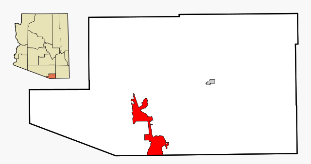
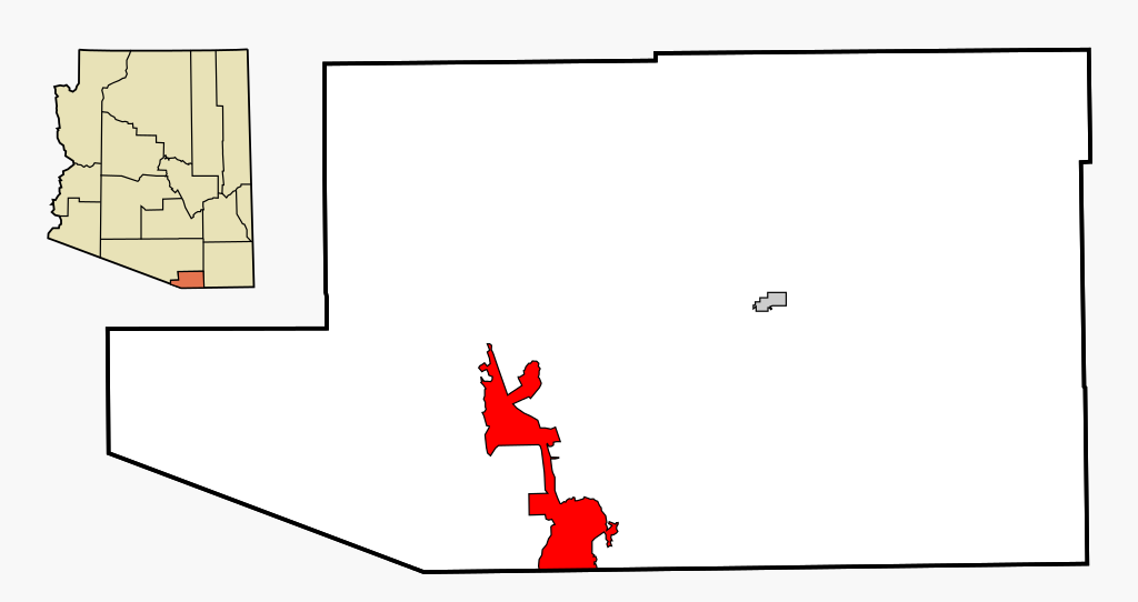
This map shows the incorporated areas and unincorporated areas in Santa Cruz County, Arizona.
|
| Dat | |
| Sous | My own work, based on public domain information |
| Kreyatè | Ixnayonthetimmay |
| Pèmisyon : (Resèvi ak fichye sa a) |
All rights not reserved. See below. |
| Autres versions | See Category:Maps of Santa Cruz County for other versions of this image. |
Kondisyon itlizasyon
| Moi, propriétaire des droits d’auteur sur cette œuvre, la place dans le domaine public. Ceci s'applique dans le monde entier. Dans certains pays, ceci peut ne pas être possible ; dans ce cas : J’accorde à toute personne le droit d’utiliser cette œuvre dans n’importe quel but, sans aucune condition, sauf celles requises par la loi. |
Istorik fichye a
Klike sou yon dat/yon lè pou wè fichye a jan li te ye nan moman sa a.
| Dat ak lè | Minyati | Grandè yo | Itilizatè | Komantè | |
|---|---|---|---|---|---|
| Kounye a | 3 mas 2007 à 02:55 | | 850 × 450 (41 kio) | Ixnayonthetimmay | {{Information |Description=This map shows the incorporated areas and unincorporated areas in Santa Cruz County, Arizona. Nogales i |
Itilizasyon fichye sa a
paj sa a itilize fichye sa a:
Itilizasyon global fichye a
Wiki sa a yo sèvi ak fichye sa a:
- Itilizasyon sou ar.wikipedia.org
- Itilizasyon sou arz.wikipedia.org
- Itilizasyon sou ca.wikipedia.org
- Itilizasyon sou ceb.wikipedia.org
- Itilizasyon sou cy.wikipedia.org
- Itilizasyon sou eu.wikipedia.org
- Itilizasyon sou fa.wikipedia.org
- Itilizasyon sou fr.wikipedia.org
- Itilizasyon sou hu.wikipedia.org
- Itilizasyon sou id.wikipedia.org
- Itilizasyon sou ps.wikipedia.org
- Itilizasyon sou pt.wikipedia.org
- Itilizasyon sou ro.wikipedia.org
- Itilizasyon sou sr.wikipedia.org
- Itilizasyon sou sv.wikipedia.org
- Itilizasyon sou tt.wikipedia.org
- Itilizasyon sou vo.wikipedia.org
- Itilizasyon sou www.wikidata.org
- Itilizasyon sou zh-min-nan.wikipedia.org